")
If you thought Perth was just about beach hangs and flat whites, think again.
This city is seriously slept on when it comes to hiking. We’re talkin’ wildflower-covered ridges, crashing waterfalls, kangaroo-filled valleys, and misty sunrises over ancient escarpments – all less than an hour from the CBD.
And the best part?
Whether you’re in the mood for a cruisy coastal stroll, a cheeky sunrise lookout, or a multi-day mission deep in the bush – Perth’s got it.
In this guide, we’ve rounded up:
✅ Perth’s best day hikes (for when ya want a quick nature fix)
✅ Multi-day trails for the hardcore RatPackers
✅ Family-friendly & accessible walks that still pack a view
✅ Epic sunset + sunrise spots for golden hour goodness
✅ When to hike (WA has its own seasons – and they slap)
✅ Pro tips to keep you safe, comfy, and prepped like a legend
Chuck it in your bookmarks, send it to the crew, and start planning your next trail sesh.
Let’s go walkabout, the RatPack way 🥾🌅
Click images to see more.
Why Hiking Around Perth is a Vibe
Perth seriously doesn’t get enough credit for how wicked its hiking scene is. You’re never far from beaut bushland, wildflowers that look like they’ve been designed by Pixar, and lookouts that’ll make you stop and go “no way that’s real”.
Here’s why hiking around Perth hits different 👇
You’re Walking Through a Global Biodiversity Hotspot
This ain’t your everyday bushwalk, RatPacker…
You’re hiking inside one of the world’s 34 official biodiversity hotspots. Big title. Big energy.
- Over 8,000 plant species in WA’s South West
- 80% of them grow nowhere else on the planet
- Expect wildflowers, funky-shaped shrubs and colours you’ve never seen before
Nature is straight-up flexing here – it’s a whole vibe.
Nature is Basically on Your Doorstep
One of the beaut things about Perth?
You don’t need to slog it hours out of the city to find epic trails.
Most of the big hitters are only 30-45 minutes from the CBD:
- Lesmurdie Falls – sunset here? Majestic.
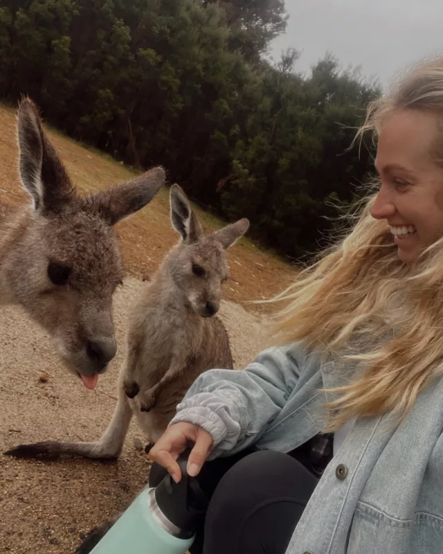
- Bells Rapids – kangaroos on tap.
- Bold Park – skyline views for dayyyyyys.
Finish your coffee in the city → hit the trail before midday → be back for a delish dinner.
So easy. So Perth.

You Hike Through the Noongar Six Seasons
Now this bit is proper special…
When you’re out on the trails around Perth, you’re walking on Whadjuk Noongar Country, and the local Noongar people (the Traditional Custodians of the south-west of WA) have their own incredible way of reading the land.
Forget just summer and winter, they recognise six unique seasons based on what’s actually happening in nature: plant cycles, animal behaviour, weather changes, all the stuff you actually notice when you slow down and look around.
Here’s a little breakdown:
Birak (Dec–Jan)
Hot and dry. You’ll see the Moodjar tree (WA’s Christmas Tree) light up with bright orange blooms. Fires are traditionally used to burn off bushland in a controlled way. Epic time for sunsets too.
Bunuru (Feb–Mar)
The hottest season. Perfect for coastal trails and swims after a sweaty walk. Not much rain – but a great time to see shady areas and freshwater spots still flowing.
Djeran (Apr–May)
Cooler days start kicking in. Plants start flowering again. Breezy arvos and that classic “this is why autumn’s elite” vibe.
Makuru (Jun–Jul)
Rainy season – the land gets a proper drink. It’s also when Noongar people would traditionally move inland to avoid the chill down south. Misty mornings, greenery popping off, and the air feels crisp.
Djilba (Aug–Sep)
Wildflower szn! Honestly, this is when the trails go technicolour. Loads of plant life blooms – it’s THE time to hit spots like Kings Park or Wireless Hill for that flower content.
Kambarang (Oct–Nov)
Warmer weather creeps in, reptiles start reappearing, and there’s a buzz in the air. Another beaut wildflower window. Kangaroo sightings pick up too!
So yeah, hiking here isn’t just a walk – it’s a way to experience how deeply connected the land, weather and wildlife are. You’ll start noticing the little shifts, and it adds a whole new layer to the experience.
Honestly? You’ll never look at a change in weather the same again.
Best Day Hikes Close to the City
Perth’s got that rare combo of banging city and epic nature just around the corner. So if you’re not vibing with a full-day roadie, these day hikes are perfect to stretch the legs, snap some beaut views and still be back in time for dinner and a cold one 🍻
Here’s our line-up of absolute legends in the day-hike game – all under 1 hour from the CBD 👇
Kitty’s Gorge Walk Trail – Serpentine National Park
📍 Distance from Perth: ~55 mins south-east
The Vibe: One of Perth’s most underrated trails – proper bushwalking energy that feels remote without actually being miles away. The track follows lush brooks and rivers, contrasting beautifully with the drier jarrah forest ridges. You’ll feel a million miles from the city.
The Stats
🟢 Distance: 16–17.5 km return
⚠️ Difficulty: Grade 4 – moderate to tough (steep bits, loose gravel, rock hopping)
⏱ Time: 4-6 hours
Trail Highlights
- Granite cascades + mini waterfalls (flowing best in winter & spring)
- The wild tale of “Kitty” – a cow that got lost down here way back when 😅
- Gooralong Brook scenery – mega lush
RatPack Tip: Park at Jarrahdale Cemetery to start at the top – this lets you hike down into the gorge first (but remember, what goes down must come back up!).
Eagle View Walk Trail – John Forrest National Park
📍 Distance from Perth: ~40 mins east
The Vibe: An iconic loop that gives you a bit of everything: waterfalls, bushland, and sweeping views across the Swan Coastal Plain all the way to the city skyline and ocean. Legit WA hiking royalty.
The Stats
🟢 Distance: 15–16 km loop
⚠️ Difficulty: Grade 3–4 (decent climbs, uneven terrain)
⏱ Time: 5–6 hours
Trail Highlights
- Seasonal waterfalls: Hovea Falls & National Park Falls
- Epic lookout points with Perth city views
- Yellow triangle markers with an eagle silhouette – follow these bad boys for the full loop
RatPack Tip: Go clockwise – trust us, the trail is marked for that direction and it’s way easier to navigate.

Bells Rapids – Swan Valley
📍 Distance from Perth: ~45 mins north-east
The Vibe: High-energy river buzz. This place goes off during the Avon Descent white-water race, but it’s a beaut spot for a quiet weekday hike too. Wild views, rushing water, and a couple of cheeky climbs.
The Stats
🟢 River Walk: 2.5 km (easy, flat)
🟡 Goat Walk: 3 km (steep, a leg burner)
🔁 Combined Loop: ~5.5 km
⚠️ Difficulty: Grade 3 overall – expect loose gravel and steep inclines on the Goat Walk
Trail Highlights
- Wooden bridge over the rapids = beaut photo op
- Top-tier valley views from the Goat Walk summit
- Springtime wildflower alert: yellow Golden Wreath Wattles covering the hills (Aug–Sep)
RatPack Tip: Start early in spring – the wildflowers pop off and you’ll dodge the midday heat.
Lesmurdie Falls – Mundy Regional Park
📍 Distance from Perth: ~35 mins east
The Vibe:
An absolute crowd fave and hands-down one of the best sunset spots in Perth. Big waterfall energy, skyline views and a super satisfying trail for a morning or arvo hike.
The Stats
🟢 Distance: ~3 km return (Valley Loop)
⚠️ Difficulty: Grade 3 – a bit of up and down, especially if you head to the base of the falls
⏱ Time: 1.5-2 hours
Trail Highlights
- Two epic lookouts – one with a clear shot of the city skyline
- Walk down to the base for a misty waterfall moment
- Insane sunset views over Perth + Indian Ocean
RatPack Tip: Arrive 45 mins before sunset for golden hour magic. The city lights start twinkling just as the sun dips – pure trail gold.
Multi-Day Hikes (For the Hardcore RatPackers)
Alright trail legends – this section’s for the RatPackers who are keen to leave the city waaay behind and hit the big tracks.
We’re talkin’ sleeping in trail shelters, carrying your gear, and waking up with sunrise views that don’t even look real 🌄
Whether you’re roadtripping in a camper and want to mix in a multi-day hiking mission, or you’re backpacking your way across WA, these trails bring the goods.
The Bibbulmun Track (Northern Terminus Taster)
📍 Start Point: Kalamunda (40 mins east of Perth)
📏 Full Track: 1,003 km (!!) – all the way to Albany
🛏️ This Section: Ideal 2–3 day overnighter to sample the start
The Vibe: One of the longest and most legendary trails in the world, the Bibbulmun (aka “The Bibb”) weaves through jarrah forest, granite outcrops and peaceful valleys. Most people take 6-8 weeks to walk the full thing, but you can get a proper taste in just a weekend.
Suggested 3-Day Itinerary
Day 1: Kalamunda to Hewett’s Hill Campsite – 10.2 km. The trail kicks off strong – straight into a lush valley descent followed by a decent climb.
Camp Vibe: Basic timber shelter (3-sided), drop toilet, rainwater tank (always treat water before drinking).
Tip: Arrive early and walk into Kalamunda town centre for a pre-trail coffee and snack stock-up.
Day 2: Hewett’s Hill to Ball Creek Campsite – 10.6 km A chill section with killer views over Mundaring Weir from Golden View Lookout.
Feeling boujee? Take a cheeky detour (1–2 km off trail) to the Mundaring Weir Hotel for a pub meal and a real bed 👀
Day 3: Ball Creek to Helena Campsite (~10–12 km) OR Exit at Mundaring Weir
Helena Campsite is one of the prettiest on the Bibb – proper sunrise magic. Short on time? You can exit via spur trails back to the Weir for pick-up.
RatPack Tips:
- Free camping is only allowed at the official Bibb shelters
- Use the Bibbulmun Track Foundation site or app to check trail closures & water tank levels
- Bring a filter or tablets – no guarantee the tanks are full (especially in summer)

The Cape to Cape Track (Margaret River Region)
📍 Start Point: Cape Naturaliste
📍 End Point: Cape Leeuwin
📏 Full Track: 124–135 km
🧭 Weekend Option: Cape Naturaliste to Sugarloaf Rock (3.5 km one way)
The Vibe:If waking up to the sound of waves crashing, hiking along clifftops with the sea breeze in your face, and ending your day with sunset over the Indian Ocean sounds like a bit of you – this is your trail.
The Cape to Cape Track runs the length of the Margaret River region, linking iconic surf spots, forest trails, limestone caves and rugged beaches. Unlike forest hikes like the Bibbulmun, this one’s got serious coastal drama and that fresh, salty air energy. Big yes.
Wanna Go Full Send?
The full trail takes 5-7 days to walk end to end, but you don’t have to commit to the whole thing. There are loads of 2-3 day sections that make it easy to dip in and get a proper multi-day hiking experience.
One of our faves?
Contos to Hamelin Bay (Multi-Day Highlight)
- Distance: ~35-40 km over 2–3 days
- Trail Vibes: Karri forests, cave entrances, clifftops, and a dreamy beach finish
- Camp: Stay at Conto Campground, or use official sites and walk-in beach camping zones
- Bonus: If you’re lucky, you might see stingrays gliding through the shallows at Hamelin Bay 🐠
Not Ready for Multi-Day? Try This Taster Walk
If you’re keen to get a feel for the Cape to Cape before going all in, this short intro section is perfect.
Cape Naturaliste to Sugarloaf Rock
- Distance: ~3.5 km (1 way)
- Time: 1–1.5 hrs each way
- Trail Type: Paved boardwalk + flat trail = super easy
- Access: Fully accessible – great for all levels, prams + wheelchairs included
The Buzz: You’ll cruise from the lighthouse out to a massive rock formation that looks like it’s been dropped from another planet (that’s Sugarloaf Rock). It’s dramatic, photogenic, and ideal if you’re just doing a short stop while roadtripping through Margs.
RatPack Tips (for any Cape to Cape mission):
- Conto Campground is the best base for multi-day sections – van-friendly, too
- Bring solid socks – long beach slogs = sneaky calf killer
- It gets windy AF on the cliffs – pack layers, even in summer
- Download maps offline – phone service drops in and out along the coast
- Showers? Lol. Not on trail. But there’s the ocean 😅
This track’s got everything: beach camps, proper views, and the freedom to go short or long depending on your vibe.
Wanna hike it then cruise into a Margs winery with trail dust still on ya legs? We’re into it. Wanna do the full lighthouse-to-lighthouse journey and feel like Bear Grylls with a better tan? We’re into that too.
Family-Friendly Walks & Accessible Trails
Not every trail needs to be a thigh-burner, ya know?
Whether you’re roadtripping with the fam, pushing a pram, or just chasing a cruisy nature sesh with zero sketchy terrain – these mellow loops are all about easy wins, beaut views, and good old-fashioned fresh air.
Here’s a few that tick all the boxes – flat, fun, and still feel like a proper Aussie bush walk 👇
Lake Leschenaultia Loop – Chidlow
📍Drive Time: ~50 mins east of Perth
🔁Distance: 3 km loop
🛣Surface: Smooth gravel and dirt (no drama)
♿Access: Rugged pram + wheelchair friendly
The Vibe: This one’s a fave for a reason. You’ll cruise around a scenic lake, no hills, no stress – just birdsong, calm water and tall gums lining the trail. And when you’re done? Jump in for a swim, hire a canoe or hit the BBQs and kick back for the arvo.
Why it’s a win:
- No traffic, fully contained loop = safe for the littlies
- Chill picnic zones + clear water for swimming
- Feels like you’ve escaped the city – without driving for hours
RatPack Tip: Bring a floatie, a few snag rolls, and make a day of it. You’re not rushing anywhere here.

John George Trail – Swan River (Woodbridge)
📍Drive Time: ~30 mins from Perth
🔁Distance: Up to 5.5 km return (do as much or little as you like)
🛣Surface: Combo of pavement + gravel
♿Access: Fully accessible – prams, chairs, the lot
The Vibe: A gentle riverside wander with plenty to see. You’ll start at a next-level playground (massive, fenced, shaded) and then roll along the river path past paddocks, birdlife and big ol’ trees. It’s peaceful, open and never too busy.
Why it’s a win:
- Easy trail = no tantrums halfway in
- Spot pelicans, ducks and horses along the way
- Great mix of green space + water views
RatPack Tip: Let the kids go wild at the playground before or after the walk. It’s got everything – slides, flying fox, BBQs and toilets. You’ll look like a pro.
Whiteman Park – Wunanga & Werillyiup Trails
📍Drive Time: ~25 mins north-east of the city
🔁Trail Options:
- Wunanga Trail: 4.3 km
- Werillyiup Trail: 2.5 km
🛣 Surface: Flat bush tracks
♿ Access: Not paved, but fine for rugged prams and cruisy walkers
The Vibe: Whiteman Park is more than just a walk – it’s a whole vibe. You’ve got bush trails, kangaroo spotting, vintage trams, wildlife encounters, museums, and even a lolly shop (dangerous, we know).
The trails weave through peaceful woodland where roos often hang out. There’s loads of space, shady paths and that classic Aussie bush smell – eucalyptus + sunshine.
Why it’s a win:
- Easy trails with big nature energy
- Wild kangaroos = crowd-pleaser
- Hop on a tram to start the walk – how’s that for old-school cool?
RatPack Tip: Catch the electric tram from the village to the trailhead. Even if you’re not 5 years old… it’s a bit of fun.
Low effort, high reward – that’s what this section is all about.
Chuck your snacks in the van, grab the crew, and take it easy on one of these local gems. Whether it’s a swim, a tram ride or a wander under the trees, these walks prove you don’t need to go full Bear Grylls to have a cracking day out.

Top Sunset & Sunrise Trails
If there’s one thing WA knows how to do – it’s sky shows.
Perth’s sunsets and sunrises are next level – we’re talkin’ misty valleys, golden ocean glows, and skyline views that’ll make your camera work overtime. Whether you’re chasing a quiet solo sunrise or rolling up with the crew for golden hour hangs, these spots are defo worth setting the alarm for.
Let’s break it down 👇
Sunset Spots – West-Facing Views That Pop Off
Lesmurdie Falls – Mundy Regional Park
The Vibe: The upper lookout here is one of the best sunset photo ops in Perth. Watch the light dip behind the skyline while the waterfall sparkles.
📍 Drive Time: ~35 mins from Perth
🔥 Best View: Upper picnic area lookout
📸 Why it Slaps: City + waterfall + Indian Ocean = big combo energy
RatPack Tip: Rock up 45 mins before sunset to catch the full golden glow show. It gets busy – early bird gets the best perch.
Lions Lookout – Welshpool Road East
The Vibe: Can’t be bothered hiking? No dramas. This one’s a drive-up sunset spot that still delivers a full 180° stunner.
📍 Drive Time: ~30 mins from Perth
🚗 Access: Carpark right near the lookout – short trail optional
🌃 Bonus: Sticks around after dark to watch the city lights sparkle across the plain.
RatPack Tip: Bring snacks, tunes and settle in. It’s a beaut place to chill out post-hike or pre-dinner.
Reabold Hill – Bold Park
The Vibe: Perth’s highest natural coastal point – it’s like watching the sun dip into the ocean from a floating boardwalk.
📍 Drive Time: ~20 mins west of Perth
📏 Height: 85m above sea level – not Everest, but gets the job done
🌅 Why it Rocks: 360° views + ocean + bushland = big sky energy
RatPack Tip: Hit this one on a clear day for max ocean sparkle. Sunset here feels like a screensaver come to life.
Sunrise Spots – East-Facing Magic Mornings
Kings Park – Fraser Avenue Lookout
The Vibe: One of the quietest times to hit this iconic spot – 6 AM, barely a soul in sight, city skyline silhouetted, Swan River glowing.
📍 Drive Time: ~5 mins from the CBD
🌤 Best Angle: Looking east across the river toward the Darling Scarp
😌 Why it Hits: Peaceful AF – no buses, no bustle, just birdsong + soft light
RatPack Tip: Grab a takeaway coffee on the way and make it a sunrise stroll along the Lotterywest Federation Walkway.

Bells Rapids – Avon Valley
The Vibe: If you’re lucky, you’ll catch low fog hugging the valley, backlit by the sunrise as it spills over the hills. Misty morning magic.
📍 Drive Time: ~45 mins north-east of Perth
🧗♀️ Best Spot: Either on the bridge or up the Goat Walk trail
💨 Best Season: Winter – for that foggy morning theatre
RatPack Tip: Chuck on a jumper, grab a thermos, and hit the trail before the sun peeks over the ridge. It’s quiet, fresh and next-level scenic.
Seasonal Highlight: Best Time of Year to Hike
Right, here’s the go…
That whole “spring, summer, autumn, winter” vibe? Doesn’t really work in WA. Over here, we follow the Noongar Six Seasons – a system that actually matches what’s really going on in the Aussie bush.
Think wildflower explosions, proper waterfall flow, misty mornings, and (yep) snakes getting a bit too active for comfort 🐍
So if you want to time your hikes like a local, this is your cheat sheet 👇
The Noongar Six Seasons
Birak (Dec–Jan) – Hot and dry
Welcome to the start of fire season-— and the heat is real. Dry landscapes, bushflies on the attack, and high fire risk mean this one’s best for early morning walks or coastal strolls only.
🥵 Hiking Vibe: Short & shady
🚫 Avoid: Long inland hikes – it’s too spicy out there
Bunuru (Feb–Mar) – Peak heat + zero rain
This is WA’s hottest time of the year – full sun, clear skies, and barely a breeze inland. Stick to beachside walks and cool-off spots. You’ll be sweating just looking at a trail map.
🌊 Hiking Vibe: Sunrise beach walks, waterfall dips
🧢 RatPack Tip: Pack double the water and always wear a hat
Djeran (Apr–May) – Cooler temps, autumn vibes
The heat finally chills out, and light rain returns. It’s a dream season for inland trails – no heatstroke, no mozzies, and lush green everywhere. Plus, the cultural fire season winds down, so more trails are open.
🍂 Hiking Vibe: Bushwalks, longer loops, fewer crowds
🧥 RatPack Tip: Layers – fresh mornings, sunny arvos
Makuru (Jun–Jul) – Wettest season = full waterfall mode
Bring on the waterfalls 💦
This is peak flow season for Lesmurdie Falls, Serpentine, and Kitty’s Gorge. Expect misty trails, foggy valleys, and full-on fresh forest smells.
💦 Hiking Vibe: Waterfall chasing + misty morning missions
👟 RatPack Tip: Wear grippy shoes + bring dry socks. It’s squelchy, but worth it.
Djilba (Aug–Sept) – First Spring = early wildflowers
This is when WA goes technicolour – wattles, orchids, and blue leschenaultias start blooming across the bush. Mornings can still be cool, but afternoons are mint. A top pick for flower walks without the big crowds.
🌼 Hiking Vibe: Wildflower trails + comfy temps
📸 RatPack Tip: Go early to beat the flies (they’re warming up too)

Kambarang (Oct–Nov) – Peak wildflower szn
WA’s wildflowers are absolutely poppin’ off – it’s wildflower central from the coast to the hills. Orchids, kangaroo paws, donkey orchids – you name it, they’re out.
🐍 Hiking Vibe: Sunrise walks, Insta-worthy trails
🧢 RatPack Tip: Snakes are back on the move – keep your eyes peeled and your trail manners on
Wildflower Hotspots (Sept–Nov)
Wanna see WA’s best wild blooms? These two are proper stunners:
Wireless Hill Park – Ardross
Easy strolls with donkey orchids, spider orchids, and more – accessible, photogenic, and right near the city.
Kings Park Bushland Trail – Perth
Skip the manicured garden, and hit the bush trail section. You’ll spot cowslip orchids, pink fairies, and even the odd blue sun orchid – all with the Perth skyline in the background. Big yes.
Tips for Hiking in WA
Before you go marching off into the bush thinking you’re Bear Grylls with a KeepCup, let’s get you clued up.
WA is absolute trail heaven, but it can also throw a few spicy curveballs: snakes, searing heat, zero phone signal, and flies that’ll try to move into your nostrils.
Here’s your no-fuss, RatPack-approved checklist to stay safe, sorted, and actually enjoy the hike.
Snake Safety – Meet WA’s Spicy Noodles
Don’t stress, most snakes want nothing to do with you. But it helps to know what you might come across – and what to do if one slithers into your day.
🟤 Dugite
- Brown/olive, skinny, quick
- Found in dry bush, dunes, open trails
- Nervy little things – they’ll dip before you even spot them
⚫ Tiger Snake
- Thicker, often striped
- Likes hanging around water – wetlands, rivers, creeks
If You See One:
- Stop. Freeze. Don’t flap about.
- Slowly back away
- Don’t try to “shoo” it – this isn’t a cartoon
Bitten? Don’t Panic – Do This:
- Whack on a pressure bandage
- Keep still
- Call 000 – let the pros sort it
- DON’T: wash the bite, suck it out, or re-enact a scene from Crocodile Dundee
RatPack Tip: Grab a Setopress snake bandage from any pharmacy or outdoor shop – chuck it in your daypack and forget about it (hopefully forever).

Apps That’ll Save Your 🍑
Emergency+ App
This thing uses what3words to pinpoint exactly where you are – even if you’re lost in the middle of nowhere going “I think we passed a rock??”
Example: ///brave.jungle.tiger. That’s literally a GPS coordinate. Magic.
TrailsWA App
Offline maps, burn alerts, closures, and the best local intel.
✅ Download it before your roadie – because signal disappears real fast once you hit the hills.
Trail Must-Haves (You’ll Thank Us Later)
Don’t be the one who rocks up in Vans with no water and a banana from last week. Here’s what you actually need:
Water
WA air dries you out FAST. Pack 2–3L per person for any hike over 2 hours. Even if it’s cloudy. Especially if it’s not.
Fly Net
Bushflies in spring/summer? Ruthless.
$5 fly net = the difference between peace and madness.
Decent Shoes
No thongs. No Converse. Get some proper runners or hiking kicks.
Ankle rolls ruin roadies.
Sunscreen + Hat
That Aussie UV hits like a truck – even on cloudy days. Slip, slop, slap ya legends.
Snacks
Muesli bars, trail mix, shapes, whatever – just don’t hike hangry. Energy drops = cranky campers.
Map or Screenshot
No signal? No worries… if you’ve saved the map in advance. Otherwise, say hi to your new best friend, Panic.
Mini First Aid Kit
Band-Aids, blister patches, snake bandage. You won’t need it… until you really do.
We love an adventure – but we love safe adventures even more.
WA’s trails are legendary, but if you rock up unprepared, it’ll chew you up and spit you out into the nearest fly swarm.
Pack smart. Start early. Stay chill. And always tell someone where you’re headed.

Final Thoughts Before You Hike Off
Well there ya go, legend – Perth’s trails?
Certified spicy.
You’ve got misty valley sunrises, waterfall-filled missions, wildflower madness, flat fam-friendly strolls and full-send overnighters – all within arm’s reach of the city.
Whether you’re a first-time wanderer or a seasoned bush-lover, there’s defo a trail (or five) here with your name on it.
But the real beauty? You don’t have to do it all in one hit. Pick a hike, pack your bag, and take it at your own pace. Perth’s got the landscapes, and now you’ve got the know-how to explore them like a boss.
And wanna Turn It Into a Proper Roadie? That’s where we come in 👇
At RatPack, we hook you up with:
🚌 Wicked campervans
📍 Custom trail & road trip advice (from people who’ve actually done it)
💬 Proper personal service
We’ve roadtripped every corner of WA, and we’ve got the hookup no matter your style – solo hiker, group of mates, travelling fam, or full-blown “I want to disappear into the wild for 3 months” energy.
So whether you’re planning a long weekend wander, a wildflower chasing loop, or a full Perth–Margaret River–Esperance kind of adventure…
Click here and we’ll help you plan it, book it, and make it all just hit better.
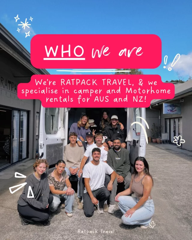
About the Author: Sammy
with RatPack Travel?

5-Star Google Rated


Our Customers Say it Best