Some drives are about getting from A to B. These are the trip itself. When people ask me for the best drives in Australia, I don’t reach for the longest routes. I reach for the roads worth driving for their own sake, the ones where the scenery does the work.
Most can be done in a day or a weekend, so they work as a quick escape or the highlight of a bigger trip. I’ve grouped them by landscape, so pick your kind of country and go. Planning a longer journey around one? Our guide to the best road trips in Australia has the bigger routes.
____________________________________________________
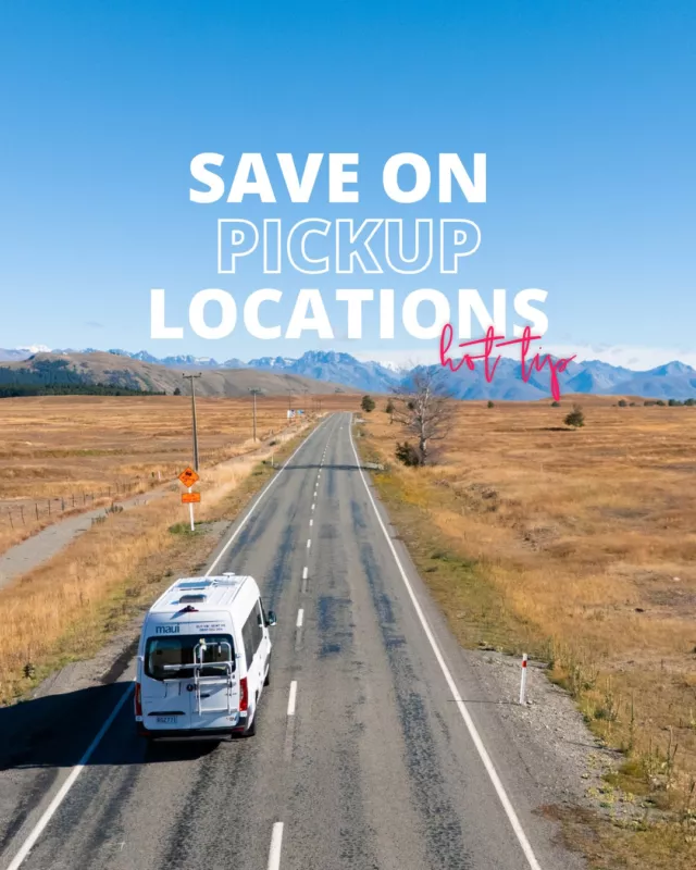
Planning a campervan trip?
Share your travel details and we’ll find you the best van, unlock the best deals, and tailor your perfect road trip.
____________________________________________________
What makes a great scenic drive
A great scenic drive isn’t just a pretty view from a fast road. The best ones give you reasons to stop: lookouts, short walks, a beach or a waterfall, and enough variety that the scenery keeps changing. They reward a slow pace, so build in twice as long as the raw drive time suggests, because you’ll want to pull over far more than you expect.
A few of these are also major road trips in their own right. Where that’s the case, I’ve kept the focus on why the drive is special and pointed you to a fuller route guide for the planning side.
Coastal scenic drives
Ocean on one side, the next headland pulling you forward. Coastal drives are the easiest to fall for. There’s always a lookout, a beach town or a fish-and-chip stop just ahead. If you’re after a longer trip along the water rather than a single drive, our coastal road trips guide has you covered.
Great Ocean Road, Victoria
Torquay to Allansford · 243 km · a full day or more · nearest city Melbourne
The one most people picture when they think of an Australian coastal drive, and it lives up to it. Built by returning World War I soldiers, the road threads past seaside towns, rainforest and the limestone stacks of the Twelve Apostles. The variety is the draw: surf beaches one minute, the green of the Otways the next, and there’s a fair chance of spotting koalas and kangaroos along the way.
Don’t miss
- Twelve Apostles: limestone stacks standing straight out of the ocean.
- Loch Ard Gorge: a quiet cove with a dramatic shipwreck story (I won’t spoil it before you arrive).
- Great Otway National Park: rainforest, waterfalls and easy walking trails.
- Gibson Steps: just before the Apostles, and far less crowded.
Good to know: Best from November to March, though it’s lovely year-round. Start early to beat the crowds, and stay a night in Apollo Bay so you’re not rushing.
Great Barrier Reef Drive, Queensland
Cairns to Cape Tribulation · 140 km · half a day plus · nearest city Cairns
A short coastal run with a lot packed in. The road runs along the Coral Sea before reaching the Daintree, one of the oldest rainforests on the planet(and it happens to be David Attenborough’s favourite). It’s the rare drive where reef and rainforest meet, and the colour of the water alone is worth the trip.
Don’t miss
- Palm Cove: a relaxed beachside village for a swim and a bite.
- Rex Lookout: wide views back along the coast.
- Cape Tribulation: this is where the rainforest runs right down to the sand.
Good to know: Best in the dry season, May to October. Keep an eye out for cassowaries near the Daintree, and take care near rivers and estuaries… this is croc country!
Grand Pacific Drive, New South Wales
Royal National Park to Shoalhaven · 140 km · half to full day · nearest city Sydney
An easy escape just south of Sydney, and a great option if you’ve only got a day. The highlight is the Sea Cliff Bridge, which curves out over the water below the cliffs, but the whole run links beaches, rainforest and seaside towns. It’s a lovely first taste of the South Coast, and one of the most popular scenic drives near Sydney.
Don’t miss
- Sea Cliff Bridge: best at sunrise or sunset, when the light hits the cliffs.
- Kiama Blowhole: one of the largest in the world on a good swell.
- Jervis Bay: white sand and clear water; worth staying the night.
Good to know: Spring and autumn bring the best weather. Weekends get busy around the bridge, so a weekday run is more relaxed.
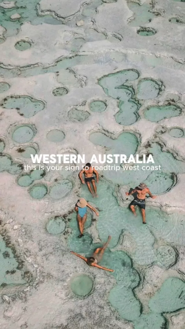
Caves Road, Western Australia
Busselton to Augusta · 110 km · a full day · nearest city Perth
The scenic spine of the Margaret River region. Caves Road runs through tall karri forest and past the limestone caves the area is named for, with the coast never far away. You can make it as simple or as indulgent as you like.
Don’t miss
- Mammoth Cave: an easy self-guided walk through the limestone.
- Boranup Karri Forest: towering trees lining the road; ideal for a picnic.
- Cape Leeuwin: this is where the Indian and Southern Oceans meet.
Good to know: Spring for wildflowers, autumn for harvest season. Many caves charge entry, so plan your stops ahead.
75 Mile Beach, K’gari (Fraser Island), Queensland
Along K’gari’s east coast · ~120 km · a full day · access via Hervey Bay · 4WD only
Less a road than a beach that doubles as a highway. On the world’s largest sand island, 4WDs share the sand with the occasional light plane, rolling past sand cliffs, freshwater creeks and the rusting Maheno shipwreck. It’s a genuinely different way to drive, and one to plan carefully around the tides. But SO worth it!
Don’t miss
- Maheno Shipwreck: the island’s most photographed spot.
- Eli Creek: float down the clear freshwater creek.
- Indian Head: high views and a good chance of spotting marine life.
Good to know: Dry season (May to October) gives firmer sand. Drive at low tide, let your tyres down for the sand, and give dingoes plenty of space, remember these guys are wild.

Mountain scenic drives
These routes climb. You’ll find snow gums, alpine air and switchbacks that ask for a bit of focus and reward you with the kind of long views you only get up high. Take them slowly, the driving is half the pleasure, and the corners are best enjoyed at an easy pace.
Great Alpine Road, Victoria
Wangaratta to Bairnsdale · 339 km · a full day or two · nearest city Melbourne
Australia’s highest year-round sealed road, and a tour through Victoria’s best high country. It climbs from the Ovens Valley up to Mount Hotham and down into Gippsland, swapping vineyards for snow gums and back again. There’s skiing in winter, walking in summer, and good food the whole way.
Don’t miss
- Bright: famous for its autumn colour and easy-going main street.
- Mount Buffalo National Park: granite cliffs, waterfalls and walking tracks.
- Mount Hotham: a ski resort in winter, alpine walks in summer.
Good to know: Spring for wildflowers, autumn for colour, winter for snow. The climbs near Hotham are steep and winding, so take them steady, especially in the cold.
Kosciuszko Alpine Way, New South Wales
Jindabyne to Khancoban · 121 km · a full day · nearest city Canberra
A drive through the heart of the Snowy Mountains and Australia’s highest country. The road passes glacial lakes, snow gum forests and open high plains, with plenty of reasons to pull over and walk. In summer the high plains fill with wildflowers; in winter it turns to snow.
Don’t miss
- Thredbo: take the chairlift for the easiest views of Mount Kosciuszko.
- Charlotte Pass: the highest village in the country.
- Scammell’s Lookout: 360° views toward Khancoban.
Good to know: Beautiful year-round. The road is well kept but busy in peak season, so an early start gives you the quiet roads.
Lyell Highway, Tasmania
Hobart to Queenstown · ~300 km · a full day · nearest city Hobart
This one changes a lot from start to finish. You begin in green forest and valleys near Hobart and end up on the wild, open West Coast. The best part is the descent into Queenstown: the 99 Bends, a run of tight switchbacks that drops you into an old mining town that looks like nowhere else in Tassie.
Don’t miss
- Derwent Bridge: Lake St Clair and the Wall in the Wilderness carvings.
- Iron Blow Lookout: views over the old open-cut mines near Gormanston.
- Queenstown: stark, distinctive country and the West Coast Wilderness Railway.
Good to know: Summer brings the easiest conditions. The 99 Bends are steep and tight. Take them slowly, and allow extra care in the winter cold.
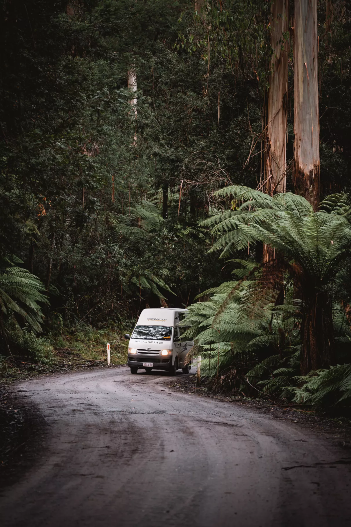
Black Spur Drive, Victoria
Healesville to Narbethong · 30 km · an hour plus stops · nearest city Melbourne
One of Victoria’s best short drives, and barely an hour from Melbourne. The road winds through tall mountain ash and tree ferns in the Yarra Ranges, with the forest close in on both sides. It’s a calm drive, and at its greenest after rain.
Don’t miss
- Fernshaw Picnic Ground: a peaceful stop for some lunch.
- Healesville Sanctuary: native wildlife at the start of the drive, and a hit with kids.
Good to know: Lovely all year, greenest in spring. Weekdays are quieter, and early mornings can be misty. Gentle going on the corners. Travelling with little ones? See our family road trips guide for more stops like this.

Outback scenic drives
Out here the scenery is the space itself. Red earth, big skies and roads that run dead straight to the horizon. These are the most remote drives on the list, so a bit of planning goes a long way. For full route logistics, fuel notes and 2WD-versus-4WD advice, see our outback road trips guide.
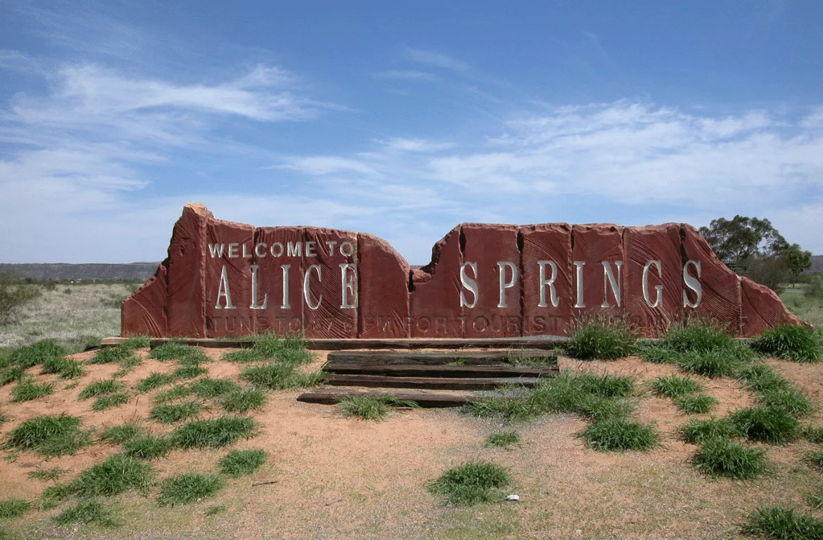
Red Centre Way, Northern Territory
Loop from Alice Springs · ~700 km · 5–6 days · nearest city Alice Springs
The classic loop through the country’s desert centre, taking in Uluru, Kata Tjuta, Kings Canyon and the West MacDonnell Ranges. The colours throughout the day, and especially at sunrise and sunset, are the reason people make the trip.
Don’t miss
- Uluru-Kata Tjuta National Park: sacred to the Anangu people, and unforgettable at dawn.
- Kings Canyon: the Rim Walk early in the morning is the standout.
- West MacDonnell Ranges: gorges and waterholes like Ormiston and Ellery Creek.
Good to know: May to September is the comfortable window. Carry plenty of water and fuel, and consider a guided walk with an Anangu guide for the cultural side.
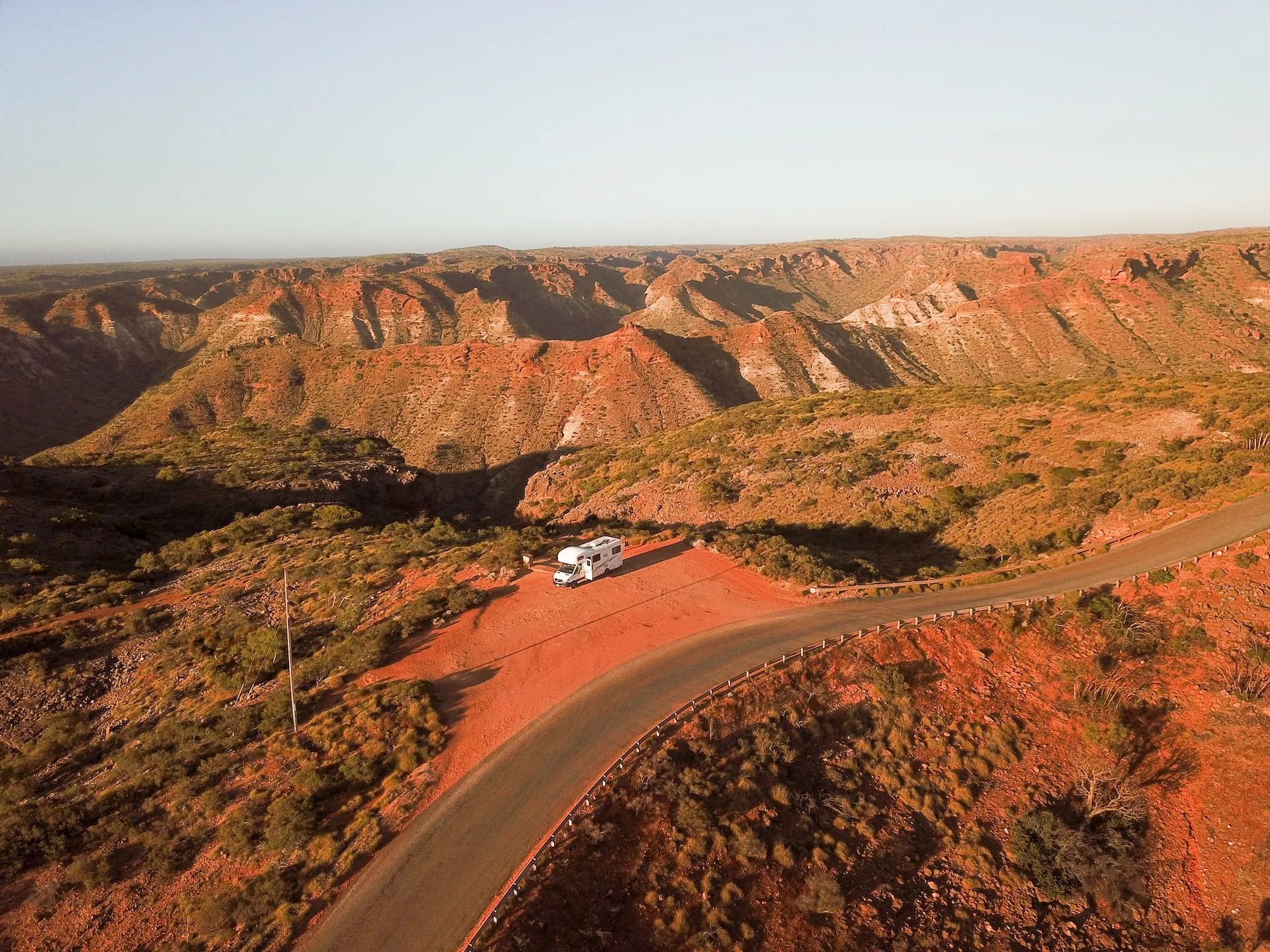
Gibb River Road, Western Australia
Derby to Kununurra · ~660 km · 5–7 days · Kimberley region · 4WD only
A legendary track through the Kimberley, and as much an experience as a drive. Between the corrugations and river crossings you’ll find gorges, waterfalls and swimming holes that feel a long way from anywhere. It’s a serious trip that rewards self-sufficiency, and the night skies out here are something else.
Don’t miss
- Bell Gorge: a waterfall into clear pools; one of the Kimberley’s finest.
- Windjana Gorge: an easy walk with freshwater crocs basking on the banks.
- El Questro: thermal springs, walks and a bit of comfort along the way.
Good to know: Dry season only (May to September). A high-clearance 4WD, spare tyres, extra fuel and water are essential – this is remote country.
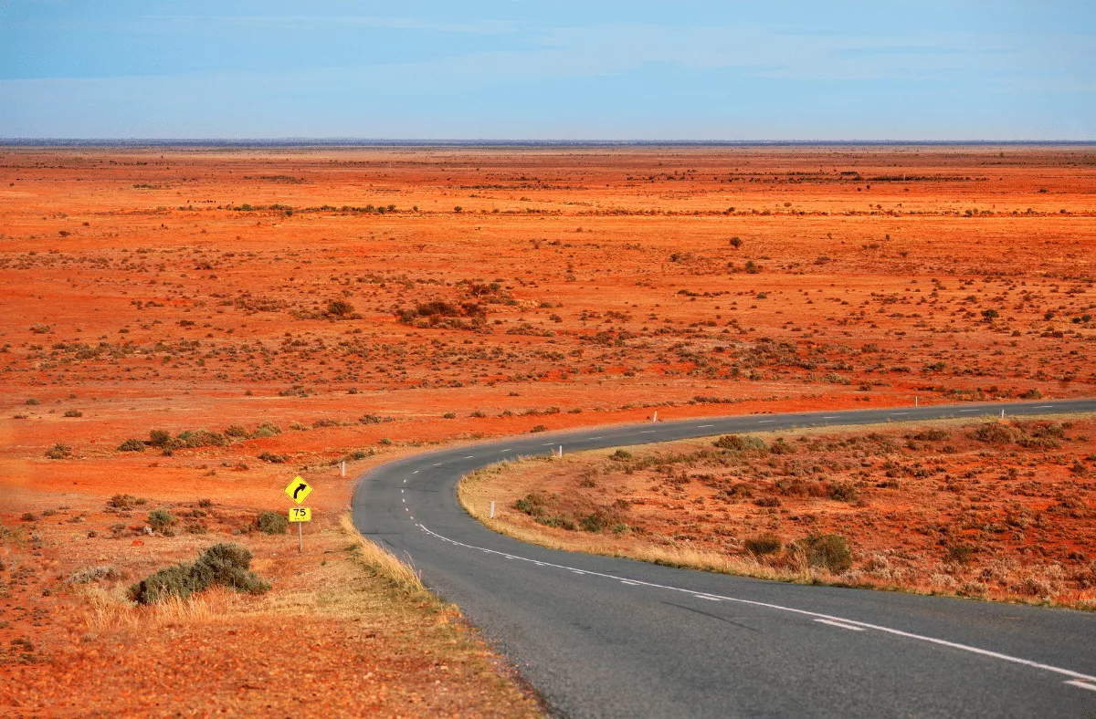
Eyre Highway and the Nullarbor, WA & SA
Norseman to Port Augusta · ~1,660 km · several days · crosses the Nullarbor Plain
A true crossing of the continent’s southern edge, and a drive that’s as much about the scale as the scenery. The Nullarbor delivers the longest dead-straight stretch of road in the country, open skies for days, and the Bunda Cliffs dropping into the Great Australian Bight. It’s big, quiet and oddly moving.
Don’t miss
- Bunda Cliffs: the coast falls away into the ocean along the Bight.
- Head of Bight: southern right whales close to shore from May to October.
- Roadhouses: Eucla and Balladonia are part of the experience.
Good to know: Cooler months (April to October) are easiest. Fuel stops are far apart and reception drops out, so plan ahead and watch for wildlife at dawn and dusk.
Brachina Gorge, Flinders Ranges, South Australia
Flinders Ranges National Park · ~35 km · half a day · nearest city Adelaide · unsealed
Known as the ‘Corridor Through Time’, this short unsealed route cuts through 650 million years of exposed rock, with interpretive signs that explain what you’re looking at. It’s a drive for anyone who likes geology, wildlife and proper outback scenery without committing to days behind the wheel.
Don’t miss
- Wilpena Pound: a natural amphitheatre of mountains, a short detour away.
- Wildlife: yellow-footed rock wallabies, emus and wedge-tailed eagles.
Good to know: April to October is the comfortable season. A 2WD can manage in dry conditions, though it gets rough after rain – carry water and supplies.
Savannah Way, Queensland to Western Australia
Cairns to Broome via the NT · ~3,700 km · weeks, not days · partly unsealed
More an expedition than a drive, the Savannah Way links Cairns to Broome across the tropical north – lava tubes, gorges and beehive-shaped domes among the highlights. We include it here for the scenery, but it’s a major undertaking; plan it properly with our outback road trips guide before you commit.
Don’t miss
- Undara Lava Tubes (QLD): one of the world’s longest lava tube systems.
- Nitmiluk / Katherine Gorge (NT): dramatic gorges, by foot or by water.
- Bungle Bungles (WA): the striped domes of Purnululu National Park.
Good to know: Dry season only. A 4WD, careful fuel planning and self-sufficiency are essential across the remote sections.
Rainforest scenic drives
If mountain drives are about the long view, rainforest drives are about the close one… Ferns, moss, light filtering through the canopy and a waterfall around the next bend. They’re cool, green and calming, and many are gentle enough for a relaxed half-day.
Waterfall Way, New South Wales
Coffs Harbour to Armidale · 185 km · a full day · nearest city Sydney
True to its name, this drive links a string of waterfalls as it climbs from the coast into the New England tablelands. The landscape shifts from subtropical rainforest to cooler high country, with World Heritage parks and easy lookouts the whole way. It’s a favourite for anyone who likes their scenery with a short walk attached.
Don’t miss
- Dorrigo National Park: rainforest walks, a skywalk and Dangar Falls.
- Wollomombi Falls: among the tallest in the country.
- Bellingen: a relaxed town for lunch or a night.
Good to know: The falls are at their best after rain. Spring and autumn bring mild weather for walking; take the curves slowly when it’s wet.
The Tarkine Drive, Tasmania
Loop in Tasmania’s northwest · 197 km · a full day · nearest city Launceston · partly unsealed
A loop through one of the world’s oldest temperate rainforests, in a remote and quiet corner of Tasmania. Towering trees, moss-covered ferns and wild rivers line the route, with short walks and a dramatic stretch of coastline at the ‘Edge of the World’. It’s a drive that rewards taking your time.
Don’t miss
- Trowutta Arch: a natural limestone arch via a short, easy walk.
- Julius River Forest Reserve: an easy stroll through ancient myrtle.
- Edge of the World: the Southern Ocean meets the coast at Arthur River.
Good to know: Best November to April, though Tassie weather is changeable. Roads are mostly unsealed and quiet. Fuel up and stock supplies before you set off.
The Rainforest Way, New South Wales & Queensland
Network of drives, Northern Rivers & Gold Coast Hinterland · 650+ km of routes · 2–5 days
A connected network of scenic drives through ancient subtropical rainforest, much of it World Heritage-listed Gondwana country. You can pick a single loop or link several, taking in lookouts, waterfalls and small hinterland villages between Byron Bay and Brisbane.
Don’t miss
- Springbrook National Park: waterfalls and the glow-worm-lit Natural Bridge.
- Lamington National Park: walking tracks and the O’Reilly’s Tree Top Walk (one of my favourite campsites is here too).
- Wollumbin (Mount Warning): a sacred site for the Bundjalung people; admire it from the designated viewpoints.
Good to know: Spring and autumn are ideal. Roads mix sealed and unsealed, so check conditions after heavy rain.
Wine country scenic drives
Rolling hills, vineyards and a long lunch at the end of it. Wine country drives are the ones to take slowly, and sensibly, with a designated driver or a tour so everyone can enjoy the cellar doors…
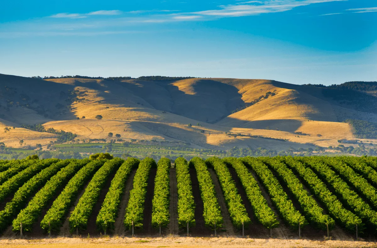
Barossa Scenic Heritage Drive, South Australia
Loop from Tanunda · 57 km · a full day · nearest city Adelaide
An easy loop through one of the country’s most celebrated wine regions, famous for its Shiraz. The drive winds past century-old vineyards, stone cottages and historic cellar doors, with gourmet stops the whole way. It’s a relaxed day of scenery and good eating.
Don’t miss
- Seppeltsfield: historic cellars and century-old fortified wines.
- Maggie Beer’s Farm Shop: a must for food lovers.
- Tanunda: heritage buildings, galleries and good dining.
Good to know: Spring and autumn are at their prettiest; late summer brings the harvest buzz. Book ahead at the popular cellar doors, and arrange a driver or tour.
Margaret River Drive, Western Australia
Busselton to Augusta · 120 km · a full day · nearest city Perth
The same beautiful Caves Road country we mention in the coastal section, seen through a food-and-wine lens. Between karri forest and surf coast sit some of Australia’s best-known wineries, alongside artisan chocolate, cheese and olive oil makers. It’s a region that rewards a slow day and an empty boot.
Don’t miss
- Vasse Felix: the region’s founding winery, with a great restaurant.
- Leeuwin Estate: known for its Art Series wines and summer concerts.
- Cape Leeuwin Lighthouse: where two oceans meet at the region’s tip.
Good to know: Spring and autumn are ideal; the Gourmet Escape festival lands in November. Build in time for the beaches at Yallingup and Prevelly.
Cultural and historic scenic drives
Some routes are scenic and really historical at the same time. Following early explorers, or tracing the country’s colonial past. These ones reward a bit of reading before you go.
The Explorer’s Way, South Australia & Northern Territory
Adelaide to Darwin via the Stuart Highway · ~3,000 km · weeks, not days
Following John McDouall Stuart’s crossing of the continent, this route runs the length of the country from the vineyards of South Australia to the tropical Top End. The landscape changes dramatically as you go, with rich cultural and historic stops along the way. It’s a major journey – pair it with our road trips guide for the planning side.
Don’t miss
- Coober Pedy: the opal town where much of life happens underground (you’ll know when you get there).
- Alice Springs: the gateway to the Red Centre, rich in Aboriginal culture.
- Katherine Gorge (Nitmiluk): dramatic gorges and cultural tours.
Good to know: May to September is the comfortable window. The Stuart Highway is long and remote, so plan fuel stops carefully.
Convict Trail, Tasmania
Hobart to Port Arthur · ~200 km · a full day · nearest city Hobart
A coastal drive through Tasmania’s convict history, ending at the Port Arthur Historic Site on the Tasman Peninsula. Between historic towns and convict-built landmarks you’ll find rugged coast and dramatic rock formations. It’s a thoughtful drive that brings the island’s early history to life.
Don’t miss
- Richmond: home to Australia’s oldest convict-built bridge.
- Port Arthur Historic Site: the centrepiece; allow most of a day.
- Tasman Arch & Devil’s Kitchen: coastal rock formations near Eaglehawk Neck.
Good to know: November to April is mildest, and autumn is quieter. Guided tours at Port Arthur are well worth it for the history.
Best scenic drives by state
If you’re starting from a particular corner of the country, here’s a quick way to find a drive close to you.
- Victoria: the Great Ocean Road, the Great Alpine Road and the short, lovely Black Spur Drive near Melbourne.
- New South Wales: the Grand Pacific Drive south of Sydney, Waterfall Way inland from Coffs Harbour, and the Kosciuszko Alpine Way in the Snowy Mountains.
- Queensland: the Great Barrier Reef Drive to Cape Tribulation, the beach highway of 75 Mile Beach on K’gari, and the rainforest loops of the Gold Coast Hinterland.
- Western Australia: Caves Road and the Margaret River Drive in the south west, and the remote Gibb River Road in the Kimberley.
- South Australia: the Barossa Scenic Heritage Drive and Brachina Gorge in the Flinders Ranges.
- Tasmania: the Lyell Highway to the West Coast, the Tarkine Drive in the northwest, and the Convict Trail to Port Arthur.
- Northern Territory: the Red Centre Way loop from Alice Springs.

Scenic drive FAQs
What is the most scenic drive in Australia?
The Great Ocean Road takes the title for most travellers. It has the variety, the famous coastline and easy access from Melbourne. For something more remote, the Gibb River Road and the Red Centre Way are unforgettable in a completely different way.
What is the best short scenic drive in Australia?
For a quick hit of beauty, it’s hard to beat the Black Spur Drive near Melbourne or the Grand Pacific Drive south of Sydney. Both pack remarkable scenery into a half-day and sit close to a major city.
Can you do these scenic drives in a 2WD or campervan?
Most of them, yes. The coastal, mountain, rainforest and wine-country drives are all comfortable in a 2WD camper. The exceptions are the remote tracks – the Gibb River Road and 75 Mile Beach need a 4WD, and Brachina Gorge is unsealed but manageable in the dry.
When is the best time of year for scenic drives?
It depends on the region. Spring and autumn suit the southern coastal and mountain drives; the tropical and outback routes are best in the dry season (May to October); and the alpine roads are at their snowiest in winter. Each drive above includes a note on timing.
How long do you need for a scenic drive?
Plan for at least double the raw drive time. A two-hour route easily fills half a day once you factor in lookouts, short walks and a meal. The whole point is to slow down, so give yourself room to stop.
Ready to hit the road?
Reading about these drives is one thing, having the right camper under you and a loose plan in your pocket is another. That’s where we come in.
Tell us your travel dates and we’ll build you a personalised camper deal – and find you the best deals, tailored to you and your style. Our team have done these trips themselves, so you get real, money-saving advice along with the keys. Start your free, no-obligation enquiry here.
Since launching in 2016 we’ve earned 3,000+ five-star reviews across Google and Facebook. If you find a cheaper price for the same booking, we’ll beat it.
About the Author
with RatPack Travel?

5-Star Google Rated
5-Star Google Rated


Our Customers Say it Best