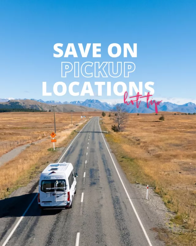
This is the big one. A Sydney to Perth road trip is the kind of trip that changes how you see this country – and probably how you see yourself, too. It’s roughly 5,500 kilometres of coastline, outback, and everything in between, stretching from the Pacific to the Indian Ocean across three states and one very long stretch of nothing in the middle.
This itinerary follows the southern coastal route which takes you through the NSW South Coast, across to Melbourne, along the Great Ocean Road, through Adelaide, across the Eyre Peninsula, over the Nullarbor, and down through Western Australia’s stunning south-west corner before rolling into Perth. We’ve spread it across 35 days, which gives you room to actually settle into each spot – swim, explore, cook dinner in the van, and wake up the next morning without needing to pack up and drive somewhere new. The beauty of travelling by campervan is that the schedule is yours, so stretch it or tighten it however you like.
____________________________________________________
Planning a campervan trip?
Share your travel details and we’ll find you the best van, unlock the best deals, and tailor your perfect road trip.
____________________________________________________
Your Epic 5-Week Sydney to Perth Road Trip Itinerary
Here’s the route at a glance:
- Week 1 – NSW South Coast: Sydney to Jervis Bay (Days 1-3), Jervis Bay to Batemans Bay (Days 4-5), Narooma to Eden (Days 6-7)
- Week 2 – Victoria: Lakes Entrance to Wilsons Promontory (Days 8-10), Phillip Island to Melbourne (Days 11-14)
- Week 3 – Great Ocean Road and South Australia: Torquay to Port Fairy (Days 15-17), Limestone Coast to Adelaide (Days 18-21)
- Week 4 – Eyre Peninsula and the Nullarbor: Adelaide to Ceduna (Days 22-25), The Nullarbor Crossing (Days 26-28)
- Week 5 – Western Australia: Esperance and Lucky Bay (Days 29-30), Albany to Denmark (Days 31-32), Margaret River and Busselton (Days 33-34), Busselton to Perth (Day 35)
Now let’s get into the detail.
But First - Which Route Should You Take?
Before we break down the itinerary, it’s worth knowing there are two main ways to drive from Sydney to Perth.
The Southern Coastal Route (This Itinerary)
This is the scenic one. It strings together the NSW South Coast, Melbourne, the Great Ocean Road, Adelaide, the Eyre Peninsula, the Nullarbor, and the spectacular south-west coast of WA. It covers roughly 5,500 kilometres over five weeks and delivers the most variety – beaches, cities, wine regions, ancient forests, and the vast Nullarbor Plain all in a single trip.
If you’ve got the time and you’re travelling by campervan from Sydney, this is the route to take. It’s what this itinerary covers in full.
The Direct Inland Route
This is the fast one. It takes you through the Blue Mountains, across to Broken Hill (or down through Wagga Wagga and Mildura as a variation), up to Port Augusta, across the Nullarbor, and straight into Perth. It’s around 3,900 kilometres and can be done in four to five days of solid driving.
There’s a raw beauty to the outback that you genuinely can’t get on the coast, and if you’re tight on time, this route has its own appeal. But for a trip of this scale, going fast feels like a waste. If you only have a week or two, consider flying one leg and driving the other – or check out our Sydney to Adelaide road trip itinerary and Adelaide to Perth road trip itinerary to tackle it in two separate trips.
Week 1: The NSW South Coast
Days 1-3: Sydney to Jervis Bay
Distance: ~190 km (approx. 2.5 hours driving)
The first few days out of Sydney are about easing into the trip. No rush, no marathon drives — just the stunning NSW South Coast unfurling ahead of you. Pick up your campervan in the morning and hit the Grand Pacific Drive heading south. That first stretch from the Royal National Park through to Wollongong sets the tone for the entire trip. With three days up your sleeve, you’ve got time to actually enjoy Jervis Bay rather than just passing through.
What to Do
Sea Cliff Bridge (Grand Pacific Drive)
You’ll spot this one long before you drive across it — a sweeping, elevated road that clings to the cliff above the ocean. It’s an incredible start to the trip and there’s a walkway if you want to get out and take it in properly. Arrive early in the morning for the best light and fewer cars.
Kiama Blowhole
A short detour into the town of Kiama brings you to one of Australia’s most powerful blowholes. When the swell is right, the spray shoots up to 25 metres. The surrounding headland walk is worth doing even if the blowhole is having a quiet day.
Hyams Beach (Jervis Bay)
Jervis Bay is where this stretch really hits its stride. Hyams Beach gets the fame (often cited as having some of the whitest sand in the world), but the whole bay is worth exploring. With two nights here, you can spend a morning swimming at Hyams, then head to the nearby Booderee National Park for coastal walks and white-sand coves without the crowds.
Dolphin and Whale Watching (Jervis Bay)
Bottlenose dolphins are regular visitors in the bay year-round, and during whale season (May to November), humpbacks pass through on their migration. Even without a boat tour, you can spot them from the headlands if you’re patient.
Booderee National Park
This one deserves its own entry because with extra time you can go deeper than most visitors. The White Sands Walk, Cave Beach, and the Botanic Gardens are all worth exploring. It’s jointly managed by the Wreck Bay Aboriginal Community, and there’s a real sense of place here that you miss if you’re only stopping for an hour.
Where to Eat
The Hungry Monkey (Jervis Bay)
Relaxed cafe vibes right near Huskisson wharf. Good coffee, solid breakfast menu, and big enough portions to fuel a morning of beach hopping. Outdoor seating is the go.
Where to Stay
Jervis Bay Holiday Park
Well-located, with powered sites that can handle campervans and motorhomes. The camp kitchen saves you money, and it’s a short walk to the beach. Book ahead during summer school holidays.
Days 4-5: Jervis Bay to Batemans Bay
Distance: ~100 km (approx. 1.5 hours driving)
A short, easy drive that lets you spend most of your time out of the van and on the beach. Batemans Bay is a good base, and the nearby Pebbly Beach is the kind of place that makes you extend your stay.
What to Do
Pebbly Beach (Murramarang National Park)
This beach is known for its resident kangaroos — they genuinely just lounge around on the sand. It’s one of those spots that sounds too good to be true, but it’s real. Late afternoon is the best time to visit when they come down to the beach.
Batemans Bay Snorkelling and Kayaking
The marine park around Batemans Bay offers clear water and decent snorkelling, especially at Malua Bay and around the Tollgate Islands. Kayak hire is available locally if you want to get out on the water.
Mogo Zoo
Just south of Batemans Bay, this small but well-run zoo is home to an impressive range of exotic animals including white lions, giraffes, and red pandas. It’s a good half-day option, especially if the weather turns.
Clyde River Oysters
Batemans Bay sits on the Clyde River, and the local oysters are excellent. You can buy them fresh from the riverside producers and eat them at a waterfront picnic table.
Where to Eat
On the Pier (Batemans Bay)
Right on the waterfront with a menu that makes the most of the local seafood. The fish and chips are reliable, and the setting is hard to beat for a casual lunch.
Where to Stay
Batemans Bay Holiday Park (Easts Beach)
Right on the beach with solid facilities — hot showers, laundry, powered sites. Great for a night or two while you explore the surrounding coastline.
Days 6-7: Narooma to Eden (The Sapphire Coast)
Distance: ~220 km (approx. 3 hours total driving)
This stretch of the NSW South Coast gets quieter and wilder as you head further south. The towns thin out, the water gets impossibly clear, and you start to feel like you’ve left the tourist trail behind entirely.
What to Do
Narooma — Montague Island Snorkelling
Montague Island, just offshore from Narooma, is home to a colony of Australian fur seals. You can book a snorkelling or diving tour to swim alongside them — they’re curious and playful, and it’s one of the most unique marine encounters on this coast. The island is also a penguin colony, so evening tours run seasonally.
Glasshouse Rocks (Narooma)
A short walk from town leads to these dramatic volcanic rock formations jutting out of the ocean. The colours shift with the light, and at low tide you can explore the rock platforms. It’s the kind of spot you’ll have mostly to yourself on a weekday morning.
Central Tilba
This entire village looks like a film set — heritage buildings, local cheese makers, craft shops, and a relaxed pub. It’s a great spot to stretch your legs and buy something that isn’t servo food. The Tilba Real Dairy does excellent cheese tastings.
Ben Boyd National Park (Eden)
Eden is the gateway to this underrated national park. The Boyd’s Tower walk takes you to a historic whaling lookout perched on red sandstone cliffs, and the Pinnacles trail reveals striking orange and white rock formations. Both walks are short and the views are outstanding.
Killer Whale Museum (Eden)
Eden has a fascinating whaling history, and this small museum tells the story well — including the famous tale of cooperative hunting between orcas and local whalers. It’s quirky, genuinely interesting, and takes about an hour.
Where to Eat
Quarterdeck Marina (Narooma)
Fresh local oysters and seafood right on the inlet. Grab a dozen oysters and eat them overlooking the water — the Narooma rock oysters are some of the best on the coast.
Where to Stay
NRMA Narooma Holiday Park
Powered and unpowered sites with water views. Solid facilities, a decent camp kitchen, and walking distance to the Narooma inlet. One of the better-run parks on this stretch.
Week 2: Victoria
Days 8-10: Lakes Entrance to Wilsons Promontory
Distance: ~370 km (approx. 5 hours total driving, spread across three days)
Crossing the NSW-Victoria border, the landscape shifts. You’ll pass through the Gippsland Lakes region — Australia’s largest inland waterway system — before heading down to Wilsons Promontory, the southernmost tip of mainland Australia. “The Prom” is a major highlight of the entire trip, and with three days on this stretch you have time to do it justice.
What to Do
Lakes Entrance Footbridge and Beaches
The long footbridge across the lake to the ocean beach is a Lakes Entrance classic. On the ocean side, you’ll find kilometres of clean, wide sand. The town itself is a solid overnight stop — grab fish and chips at the waterfront and watch the fishing boats come in.
Ninety Mile Beach
One of the longest uninterrupted beaches in the world. You can drive to access points along the Princes Highway and walk out onto stretches of sand that are almost empty. It’s a humbling kind of beautiful.
Tidal River (Wilsons Promontory National Park)
This is your base camp in the Prom. The campground sits right by the river mouth with direct beach access. From here, you can walk to Squeaky Beach, Norman Beach, and a network of trails through coastal bush. Wombats wander through the campground at dusk, which never gets old.
Squeaky Beach
A short, flat walk from Tidal River through tea-tree forest brings you to one of Australia’s most photogenic beaches. Huge, smooth granite boulders frame impossibly clear turquoise water. The sand genuinely squeaks under your feet.
Mount Oberon Summit Walk
A 3.4-kilometre return walk with a steep climb, but the 360-degree views from the top are the reward — across the Prom’s bays, islands, and bushland. Allow about two hours return and bring water.
Sealers Cove Walk
With an extra day at the Prom, you have time for this one — a 19-kilometre return trail through fern gullies and coastal forest to a secluded beach. It’s one of the best day walks in Victoria, and far quieter than the shorter trails near Tidal River. Bring lunch and plenty of water.
Where to Eat
Ferryman’s Seafood Cafe (Lakes Entrance)
Right on the waterfront with a menu built around the local catch. The seafood platter is generous and the waterside tables are ideal for a long lunch.
Where to Stay
Tidal River Campground (Wilsons Promontory)
This one books out months in advance during summer, so get in early. Powered and unpowered sites, amenities blocks, and you’ll wake up to wombats. It’s one of the best campground locations in Australia. Book through Parks Victoria.
Days 11-14: Phillip Island and Melbourne
Distance: ~140 km from Wilsons Prom to Phillip Island, then ~140 km to Melbourne (approx. 3.5 hours total driving)
Four days gives you a night on Phillip Island for the penguins and then three full days in Melbourne to recharge, eat well, and soak up the city before the long westward push. After nearly two weeks on the road, a couple of city days are welcome — and Melbourne earns every one of them.
What to Do
Phillip Island Penguin Parade
Every evening at sunset, hundreds of little penguins waddle up the beach to their burrows. It’s genuinely charming — even the most travel-weary in your group will be grinning. Book tickets in advance online, as it does sell out. The general viewing area is the most affordable option and perfectly good.
The Nobbies and Seal Rocks
A boardwalk at the western tip of Phillip Island overlooks Seal Rocks, home to Australia’s largest colony of Australian fur seals. Bring binoculars if you have them. The views back along the island’s coastline are stunning.
Melbourne Laneways and Street Art
Park the campervan and spend a day on foot. Hosier Lane, AC/DC Lane, and Degraves Street are the famous ones, but the best discoveries come from wandering without a plan. Melbourne’s food scene is exceptional, and the street art alone is worth a few hours.
Queen Victoria Market
Open since 1878, the market is where Melbourne comes to shop for produce, street food, vintage clothing, and souvenirs. Go hungry and work your way through the food stalls. The deli hall is a highlight.
St Kilda and the Esplanade
A beachside suburb with a great vibe — especially on weekends when the Esplanade Market runs. Walk down the pier at dusk and you might spot little penguins nesting among the rocks. Luna Park next door is worth a look even if you don’t ride anything.
Fitzroy and Collingwood
Melbourne’s creative heartland. Brunswick Street and Smith Street are packed with cafes, vintage shops, bars, and galleries. If you’re into the local food and music scene, this is where to spend an evening.
Where to Eat
Lune Croissanterie (Fitzroy)
If you appreciate pastry, this is a pilgrimage. The croissants are extraordinary and the space is beautiful. Expect a queue on weekends, but it moves quickly.
Where to Stay
BIG4 Melbourne Holiday Park (Fingal)
Located between the Mornington Peninsula and Phillip Island, this park is a solid base for both areas. Powered sites, camp kitchen, and modern amenities. About 90 minutes from central Melbourne.
Week 3: Great Ocean Road and South Australia
Days 15-17: The Great Ocean Road (Torquay to Port Fairy)
Distance: ~285 km (approx. 4.5 hours without stops — but you’ll want to stop constantly)
Three days on the Great Ocean Road means you can actually take it slow, catch a sunrise at the Apostles, and explore the smaller towns that most people drive straight through. We’ve covered this route in detail in our Sydney to Melbourne road trip itinerary and our Melbourne to Adelaide road trip itinerary, so we’ll hit the highlights here.
What to Do
Bells Beach (Torquay)
The spiritual home of Australian surfing. Even if you don’t surf, the viewing platform above the break gives you a front-row seat to watch the locals carve up. Torquay itself is a good spot to grab supplies before heading down the coast.
Lorne and Erskine Falls
Lorne is the Great Ocean Road’s most popular town — cafes, galleries, and a beachfront that buzzes in summer. The walk to Erskine Falls (about 30 minutes return) is an easy detour into lush rainforest just minutes from town.
The Twelve Apostles and Loch Ard Gorge
The non-negotiable stops. The Apostles are best viewed at sunrise or sunset when the light turns the limestone gold, and the crowds are thinner. Loch Ard Gorge, just down the road, is equally dramatic — towering cliffs and a sheltered gorge with a wild shipwreck story behind it.
London Arch and The Grotto
Further along from the Apostles, these natural rock formations are less crowded and equally impressive. The Grotto frames the ocean through a sinkhole — it’s one of the most photogenic spots on the entire road.
Tower Hill Wildlife Reserve (near Warrnambool)
A volcanic crater turned wildlife sanctuary. Walk the loop trail at dawn or dusk for close encounters with emus, kangaroos, and koalas. It’s free, easy access, and an underrated stop that most people drive straight past.
The Otways — Maits Rest Rainforest Walk
If you have three days on the GOR, detour into the Otway Ranges. Maits Rest is a gentle 30-minute boardwalk through ancient temperate rainforest — towering ferns, moss-covered trees, and that deep green light that only old forests have.
Where to Eat
Bottle of Milk (Lorne)
Burgers, loaded fries, and milkshakes in a fun, casual space. Always busy in summer but worth the wait. The Lorne burger is the crowd favourite.
Where to Stay
Johanna Beach Campground
Free bush camping just off the Great Ocean Road. It’s basic (pit toilets, no power), but the beach is wild and beautiful. One of the best free camping spots in Victoria. Be aware it’s exposed — crosswinds can be strong in winter.
Days 18-21: Limestone Coast to Adelaide
Distance: ~460 km from Port Fairy to Adelaide (approx. 5 hours driving, spread across four days)
With four days for this stretch, you can give Mount Gambier and the Limestone Coast proper time, detour through the Fleurieu Peninsula wine country, and still have a full day or two in Adelaide to explore and restock before the big westward push.
What to Do
Blue Lake (Mount Gambier)
Every November to March, this volcanic crater lake turns a vivid, almost unreal shade of cobalt blue. Even outside that window, the lake and surrounding crater walks are impressive. There’s a free viewing platform, and the aquifer tours give you a look at the cave system beneath the city.
Umpherston Sinkhole (Mount Gambier)
A collapsed limestone cave turned sunken garden. During the day it’s lush and beautiful; at dusk, possums emerge across the garden. Free entry and a well-maintained walking path around the rim.
Naracoorte Caves
A World Heritage site with fossilised megafauna — giant wombats, marsupial lions, and other creatures that once roamed the area. The guided cave tours are excellent and affordable. It’s a worthwhile detour if you’re interested in natural history.
Coonalpyn Silo Art
Keep an eye out for the painted grain silos as you drive through South Australia’s Limestone Coast. Coonalpyn is one of the best examples — a massive mural that you can spot from the highway. It’s part of a wider silo art trail that’s become hugely popular with road-trippers.
Fleurieu Peninsula and McLaren Vale
If you’re arriving into Adelaide from the south, the Fleurieu Peninsula route takes you through McLaren Vale — one of Australia’s best wine regions. Most cellar doors offer free or low-cost tastings, and the region produces excellent shiraz and grenache. Check out our Fleurieu Peninsula guide for the full rundown.
Adelaide Central Market
Open since 1869, this is where Adelaide eats. Over 80 stalls selling produce, cheese, baked goods, smallgoods, and ready-to-eat food from dozens of cuisines. It’s also your last chance to properly stock up on affordable groceries before heading west — prices go up significantly once you leave Adelaide.
Kangaroo Island (Optional 2-3 Day Add-On)
If your schedule allows, the ferry from Cape Jervis to Kangaroo Island is one of the best wildlife detours in Australia. Seals, sea lions, koalas, echidnas, and remarkable scenery — it’s an island that genuinely lives up to the hype. Just be aware that taking a campervan on the ferry requires booking ahead and the crossings can be affected by weather.
Where to Eat
Lucia’s Pizza and Spaghetti Bar (Adelaide)
A beloved Adelaide institution serving Italian classics in a no-fuss, always-buzzing setting. The pizza is consistently excellent and portions are generous. Get there early or expect to wait.
Where to Stay
Adelaide Shores Caravan Park
Right on the beach at West Beach, about 15 minutes from the CBD. Powered sites, good facilities, and an easy base for exploring Adelaide while keeping the campervan lifestyle going.
Week 4: Eyre Peninsula and the Nullarbor
Days 22-25: Adelaide to Ceduna (The Eyre Peninsula)
Distance: ~770 km (approx. 8.5 hours total driving, spread across four days)
Leaving Adelaide, you’re officially heading into outback territory. The Eyre Peninsula is one of the most underrated stretches of coastline in Australia — seafood capital vibes, oyster farms you can wade into, and coastal camping that rivals anything on the east coast. With four days, you can explore properly rather than just fuelling up and pushing through.
What to Do
Port Augusta
Known as the “Crossroads of Australia,” this is where the highway turns west toward the outback. It’s not a destination in itself, but it’s a good fuel and supply stop. The Wadlata Outback Centre is worth a visit if you have an hour — it tells the story of the outback landscape and its Traditional Owners.
Port Lincoln
The seafood capital of Australia. If your budget stretches to it, the marine experiences here are world-class — swimming with sea lions, tuna, and even cage diving with great white sharks. Even without the big-ticket activities, the waterfront is beautiful and the seafood is exceptional.
Coffin Bay Oysters
This is a “don’t-miss” stop. Some of the best oysters in the world come from Coffin Bay, and you can wade right into the water at the oyster farm to taste them fresh. It costs a fraction of what you’d pay in a Sydney restaurant, and the experience is incomparable.
Streaky Bay
A gorgeous coastal town with turquoise water and a relaxed pace. It’s a major campervan stopover on the Eyre Peninsula and a good place to spend a night, swim, and recharge before the long stretch ahead.
Lake MacDonnell (“Watermelon Avenue”)
Between Streaky Bay and Ceduna, you’ll pass Lake MacDonnell — a split-coloured lake where the water appears bright pink on one side and blue-green on the other, divided by a dirt road running between them. The colours shift with the seasons and light conditions, but when it’s working, it’s seriously photogenic.
Tumby Bay Silo Art
Another beautiful example of the painted silo art trail that runs through South Australia. The mural at Tumby Bay is particularly striking — a large-scale portrait that looks incredible against the outback sky.
Ceduna — The Last Big Shop
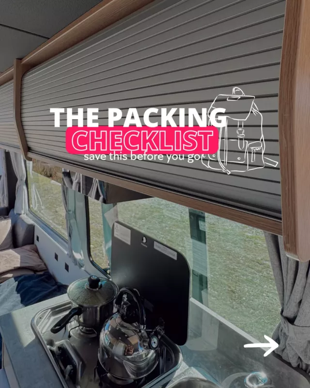
Ceduna is the last town with a proper supermarket before you cross the Nullarbor. Stock up here: water, non-perishable food, snacks, and anything else you’ll need for the next 1,200 kilometres. Fuel up completely. This is not optional — it’s essential. Check out our campervan packing list to make sure you haven’t missed anything critical.
Where to Eat
Fresh Fish Place (Port Lincoln)
Buy direct from the processing facility. It’s not a restaurant — it’s a fish shop where you can grab cooked or fresh seafood at wholesale prices. The prawn skewers and fish tacos are excellent.
Where to Stay
Ceduna Foreshore Caravan Park
Last powered campsite before the Nullarbor. Well-run, right on the water, and it has everything you need to prep for the crossing — showers, laundry, dump station, and water fill-up.
Days 26-28: Ceduna to Norseman (The Nullarbor Crossing)
Distance: ~1,200 km (approx. 13 hours total driving, spread across three days)
Here it is – the Nullarbor. The word means “no trees” in Latin, and once you’re out there, you’ll understand why. This is one of those stretches of road that people talk about for years afterwards. It’s long, it’s remote, and it’s extraordinary in a way that’s hard to explain until you’ve seen it. The sky is enormous, the road just keeps going, and the Bunda Cliffs along the Great Australian Bight are genuinely jaw-dropping.
Before you set off, make sure you’ve read our outback road trip survival guide — it covers fuel planning, water, safety tips, and what to do if things go wrong. Also worth knowing: phone reception across the Nullarbor is limited. Telstra has the best coverage, but expect extended dead zones. Download your maps offline before you leave Ceduna.
What to Do
Head of the Bight (Whale Watching)
Between May and October, southern right whales gather at the Head of the Bight to breed and calve. The viewing platforms sit atop the Bunda Cliffs, and you look straight down onto the whales below. It’s one of Australia’s best whale-watching experiences. Even outside whale season, the cliff views alone are worth the stop.
Bunda Cliffs Lookouts
The Bunda Cliffs stretch for nearly 200 kilometres along the Great Australian Bight, rising up to 120 metres above the Southern Ocean. Several lookout points are signposted along the highway — pull over at every one. The scale of these cliffs, with nothing but ocean stretching to Antarctica, is hard to overstate.
Nullarbor Roadhouse
The iconic midpoint of the crossing. Fuel up, grab a pie, and sign the guest book. The roadhouse has basic accommodation and camping, and it’s one of those places that only exists because of the road — which gives it a character all its own.
Border Village (SA/WA Border)
This is where you cross into Western Australia. Stop for the obligatory photo at the state border sign, and be prepared for the quarantine checkpoint. WA has strict rules on what food, fruit, vegetables, honey, and plant material you can bring in – anything on the banned list will be confiscated, and fines apply. Eat your fresh produce before you get here, or bin it.
Eucla and the Old Telegraph Station
The ruins of the Old Eucla Telegraph Station are slowly being consumed by shifting white sand dunes. It’s an eerie, beautiful sight – a 19th-century building half-buried in the desert. The walk from the roadhouse takes about 20 minutes.
90 Mile Straight
Despite its name, this section of road between Balladonia and Caiguna is actually 146.6 kilometres – making it Australia’s longest straight road. It’s a strange, almost meditative experience. You can see the curve of the earth from here.
Balladonia Roadhouse (Skylab Crash Site)
In 1979, pieces of the American space station Skylab fell to earth near Balladonia. The roadhouse has a small museum with pieces of the wreckage and newspaper clippings. It’s a wonderfully random bit of outback history.
Caiguna Blowhole
Just off the highway near Caiguna, a roadside cave vent visibly “breathes” air in and out due to pressure changes in the vast underground limestone network. It’s a quick stop, but the sound and feeling of the earth breathing beneath your feet is surreal.
Norseman
The official end of the Nullarbor and the crossroads where you choose to head south toward Esperance or north toward Kalgoorlie. Fill up on fuel, restock groceries, and give yourself a moment to appreciate that you just drove across the Nullarbor Plain.
Where to Eat
Eating across the Nullarbor is about roadhouse pies, pre-made sandwiches, and whatever you’ve packed in the campervan. Embrace it.
Nullarbor Roadhouse
Pies, burgers, and hot chips. The menu won’t win any awards, but after hours on the road, a hot pie and a cold drink hit differently out here.
Nullarbor Survival Tips
A few practical things that are worth knowing before you set off:
Fuel: Plan your fuel stops carefully. Roadhouses are spaced roughly 150-200 km apart, but some stretches are longer. Keep your tank above half wherever possible, and carry a jerry can if your vehicle’s range is tight. Check our guide to campervan hire costs to factor fuel into your budget.
Water: Carry at least 10 litres of drinking water per person as a safety buffer, on top of whatever you need for daily use. Dehydration in the outback is serious.
Driving at dawn and dusk: Don’t. This is when kangaroos, wombats, and emus are most active on the road, and hitting one at highway speed can be catastrophic. Plan your driving for daylight hours and pull over well before sunset.
Road trains: These can be up to 50 metres long and weigh over 100 tonnes. Give them plenty of space, and never try to overtake unless you have clear visibility for at least a kilometre. Flash your lights to say thanks when they pull over to let you pass.
Crosswinds: The Nullarbor is exposed and winds can be fierce, especially for high-sided campervans. If conditions feel dangerous, pull over and wait it out. There’s no schedule worth your safety.
If your vehicle stops working: Stay with your vehicle. The road is the only reliable way to be found. Flag down passing cars or trucks. If you have Telstra reception, call roadside assist. The Royal Flying Doctor Service operates in this region for medical emergencies.
Week 5: Western Australia
Days 29-30: Esperance and Lucky Bay (White Sand, Blue Water)
Distance: ~200 km from Norseman to Esperance (approx. 2.5 hours driving)
After the Nullarbor, the coastline around Esperance feels like a reward. The water is Caribbean-turquoise, the sand is blindingly white, and kangaroos sunbathe on the beach. This is consistently rated one of the most beautiful stretches of coast in Australia, and it delivers. Two days lets you explore both the town and the national park without rushing.
What to Do
Lucky Bay (Cape Le Grand National Park)
The most photographed beach in Western Australia, and the photos don’t even do it justice. The sand is fine, bright white, and the water is absurdly clear. Kangaroos genuinely hang out on the beach – they’re relaxed and photogenic, but give them space. You can drive onto the beach with a 4WD, but the walk from the car park is short and easy.
Hellfire Bay and Thistle Cove
Also within Cape Le Grand National Park, these two beaches are quieter alternatives to Lucky Bay and equally beautiful. Thistle Cove has a sheltered bay that’s excellent for swimming, and Hellfire Bay is dramatic and wild.
Frenchman Peak (Cape Le Grand)
A moderate climb up this distinctive rocky peak delivers panoramic views across the national park and coastline. The final section involves scrambling through a narrow cave – it’s not technical, but it’s fun. Allow about 2-3 hours return.
Pink Lake (Lake Hillier)
Lake Hillier on Middle Island is the famous pink lake visible from the air, but there are several pink or near-pink lakes around Esperance that you can visit by road. The colour varies with the seasons and conditions — sometimes vivid, sometimes subtle. Check local information centres for the best current viewing spots.
Esperance Town and Waterfront
The town itself is relaxed and welcoming, with a beautiful waterfront, a good selection of cafes, and a scenic drive that loops along the coast. The Esperance Museum has an eclectic collection, including a full-sized replica of Skylab debris.
Great Ocean Drive (Esperance)
A scenic loop drive just west of town that passes through some of the best coastal scenery in WA — Blue Haven Beach, Observatory Point, Twilight Bay, and West Beach. Each one deserves a stop, and the whole drive takes about an hour without detours.
Where to Eat
Taylor Street Jetty (Esperance)
Right on the waterfront with good fish and chips and a view over the bay. Casual, affordable, and exactly the kind of post-beach meal you want.
Where to Stay
Lucky Bay Campground (Cape Le Grand National Park)
This is where you want to be. Unpowered camping right behind one of Australia’s best beaches. Facilities are basic (pit toilets, no showers), but the location is unbeatable. Book through the WA Parks and Wildlife website — sites fill fast, especially over school holidays and long weekends.
Days 31-32: Albany to Denmark (Granite Coast and Ancient Forests)
Distance: ~480 km from Esperance to Albany (approx. 5 hours), then ~60 km to Denmark (approx. 45 min)
The drive from Esperance to Albany takes you along the Rainbow Coast — a stretch of road that reveals sweeping ocean views, wild beaches, and, between January and April, some of the best orca-watching in the southern hemisphere from Bremer Bay. Albany itself is one of WA’s most underrated towns, with a spectacular granite coastline and a deep military history.
What to Do
Bremer Bay Orca Watching (January-April)
If your timing is right, Bremer Bay is one of the few places in the world where you can reliably see orcas in the wild. Tour operators run boat trips out to the Bremer Canyon during the summer months. It’s not cheap, but encounters with killer whales in clear, open water are genuinely life-changing.
The Gap and Natural Bridge (Albany)
Two of WA’s most dramatic coastal formations. The Gap is a sheer 24-metre drop where the ocean surges into a narrow granite channel, and the Natural Bridge is a huge slab of granite suspended between two cliffs. The viewing platforms are built into the cliff edge — the perspective is thrilling.
National Anzac Centre (Albany)
Albany was the departure point for the first Anzac troops heading to Gallipoli in 1914. The National Anzac Centre is a genuinely moving, world-class museum that tells individual soldiers’ stories through interactive exhibits. Allow at least two hours.
Valley of the Giants Tree Top Walk (Denmark)
A 600-metre elevated walkway suspended up to 40 metres above the forest floor among ancient tingle trees. Some of these trees are over 400 years old, and walking through their canopy is humbling. The Ancient Empire boardwalk at ground level takes you through the base of the giants — some hollowed out into rooms you can walk through.
Greens Pool (Denmark)
One of WA’s most beautiful beaches. A sheltered bay surrounded by granite boulders with crystal-clear water that stays calm even when the ocean outside is rough. Brilliant for swimming and snorkelling.
Elephant Rocks (Denmark)
Right next to Greens Pool, these massive, smooth granite boulders sit in the shallows and look remarkably like elephants wading into the water. Short walk from the car park and incredibly photogenic.
Where to Eat
Pepper and Salt (Denmark)
Set on a hillside among the karri trees with views over the valley. The menu is locally sourced and seasonal, and it’s one of the best regional restaurants in WA. Worth booking ahead.
Where to Stay
Cosy Corner Beach Campground (near Albany)
Run by WA Parks and Wildlife, this is a beautiful coastal bush camp with basic facilities. Sites are unpowered, but the setting — right behind a wild, rocky beach — is magic. Book online.
Days 33-34: Margaret River and Busselton (Wine, Surf, and the Long Jetty)
Distance: ~280 km from Denmark to Margaret River (approx. 3.5 hours), then ~50 km to Busselton
The Margaret River region is where Western Australia shows its sophistication. World-class wineries sit alongside legendary surf breaks, and ancient limestone caves run beneath the karri forests. Two days gives you time to taste wine, explore the caves, and catch sunset from the Busselton Jetty.
What to Do
Margaret River Wineries
Over 150 cellar doors in the region, with many offering free or low-cost tastings. The region is best known for cabernet sauvignon and chardonnay. If you’re on a budget, focus on the smaller, family-run wineries — they’re often more generous with tastings and more interesting to talk to. Designate a driver or plan a cycling wine tour.
Mammoth Cave
One of several limestone caves in the region, Mammoth Cave is a self-guided experience (audio tour) through a 500,000-year-old cave system containing fossils of ancient megafauna. It’s atmospheric, accessible, and takes about an hour.
Hamelin Bay Stingrays
In the shallow waters of Hamelin Bay, large wild stingrays glide right up to the shoreline. You can wade in and watch them cruise past your feet. It’s free, it’s surreal, and it makes for incredible photos. Best in the morning when the water is calm.
Busselton Jetty
At 1.8 kilometres long, Busselton Jetty is the longest timber-piled jetty in the southern hemisphere. You can walk it, take the solar-powered train to the end, or visit the Underwater Observatory at the jetty’s tip — an underwater viewing chamber surrounded by a coral reef that’s grown around the pylons.
Surfers Point (Margaret River)
Even if you don’t surf, watching the locals ride the powerful breaks at Surfers Point is a spectacle. The reef breaks here attract serious surfers from around the world.
Gnomesville (Wellington Mill)
A quirky, slightly surreal forest clearing filled with thousands of garden gnomes left by visitors from around the world. It’s free, it’s weird, and it’s one of those WA things that you just have to see. Bring a gnome to leave behind if you want to join the tradition.
Where to Eat
Morries (Margaret River)
A burger and anytime-food joint that’s become a local institution. The burgers are excellent, the vibe is casual, and the prices are reasonable for the region.
If you’re here on a Saturday, the farmers’ market is the best way to experience the region’s produce. Local cheeses, breads, oils, chocolates, and ready-to-eat food. Great for stocking up the campervan kitchen too.
Where to Stay
Prevelly Caravan Park
Closest park to the coast in the Margaret River area. Basic but well-located, with powered and unpowered sites. Walking distance to Surfers Point and the river mouth.
Bush camping near Margaret River in the national park. Basic facilities, unpowered sites, and surrounded by karri forest. It’s quiet, peaceful, and feels miles from anywhere. Book through WA Parks and Wildlife.
Day 35: Busselton to Perth (The Home Stretch)
Distance: ~230 km (approx. 2.5 hours driving)
The final push to Perth is a surprisingly easy drive — flat, well-maintained highway through the Swan Coastal Plain. After five weeks on the road, rolling into Perth feels like a genuine achievement. You’ve just driven across the entire country.
What to Do
Bunbury Dolphin Discovery Centre
A quick stop on the way up. Bunbury is home to a resident pod of bottlenose dolphins that regularly swim into Koombana Bay. The Discovery Centre offers a chance to wade in and see them up close during swim season (November to April).
Mandurah Estuary
A beautiful estuary town about an hour south of Perth. The boardwalk along the waterfront is a nice leg-stretch, and the local fish and chips are excellent.
Fremantle
Consider dropping the campervan back in Perth and spending your last day or two in Freo. The port city has its own distinct personality — historic architecture, lively markets, craft breweries, and some of the best street food in WA. The Fremantle Markets (open Friday to Sunday) are a must.
Rottnest Island
The perfect full-stop to the trip. A short ferry from Fremantle takes you to Rottnest Island, where you can hire bikes, snorkel, and get a selfie with a quokka — widely known as the world’s happiest animal. It’s a day trip that feels like a reward for the thousands of kilometres behind you.
Kings Park (Perth)
If you only do one thing in Perth, walk through Kings Park. The botanical gardens and bushland park offer panoramic views of the city, the Swan River, and the Darling Ranges. The DNA Tower and the Federation Walkway through the treetops are highlights.
Where to Eat
Bathers Beach House (Fremantle)
Right on the beach with your feet practically in the sand. Fresh seafood, good cocktails, and a sunset view that’s the perfect way to toast the end of your road trip.
Where to Stay
Discovery Parks – Perth Airport
Convenient if you’re dropping the campervan back to a Perth depot the next morning. Powered sites, good amenities, and easy access to the airport.
Other Things to Consider on Your Sydney to Perth Road Trip
Is the route from Sydney to Perth worth it?
Absolutely. It’s one of the great road trips on the planet — not just in Australia. You cross three states, drive some of the most varied landscapes in the world, and experience everything from cosmopolitan cities to genuine outback wilderness. The Nullarbor crossing alone is something most people never forget.
How long does it take to drive from Sydney to Perth?
The direct inland route covers roughly 3,900 km and takes about 41 hours of pure driving time. The scenic coastal route in this itinerary covers around 5,500 km. We’ve spread it across 35 days, which gives you a genuinely comfortable pace — time to explore, rest, and enjoy each spot rather than racing to the next one. Most people who rush this trip wish they’d taken longer.
Can you drive from Sydney to Perth in a day?
Technically no – even the direct route takes over 40 hours of non-stop driving. You’d need at least four full days of hard driving with minimal stops, and that’s not a road trip, that’s an endurance test. The whole point is to take your time.
What is the best time of year to drive from Sydney to Perth?
- Spring (Sep-Nov): One of the best windows. Wildflower season in WA, mild temperatures across most of the route, and whale watching at Head of the Bight is still possible in early spring. It’s warm enough for beach days without the intense heat.
- Summer (Dec-Feb): Peak travel season and school holidays mean busier campsites and higher prices. The Nullarbor can be brutally hot (40°C+), and flies are relentless. If you go in summer, plan your Nullarbor crossing for the earliest and latest hours of daylight, and carry extra water. The south-west WA section is beautiful in summer. Check our best travel times for Australia guide for more detail.
- Autumn (Mar-May): Excellent. The heat eases off, the crowds thin, and the colours are beautiful across the southern states. Water temperatures are still swimmable into April. Orca season at Bremer Bay runs until April. This is arguably the sweet spot for this trip.
- Winter (Jun-Aug): Cooler and wetter in the south, but still doable. The Nullarbor is more comfortable temperature-wise, but nights are cold. The Great Ocean Road and south-west WA get winter swells and rain. Whale season begins at Head of the Bight (June onwards), which is a major drawcard.
What’s the climate like between Sydney and Perth?
You’ll experience everything. The NSW and Victorian coasts are temperate and mild. Adelaide and the Eyre Peninsula get hot and dry in summer, milder in autumn and spring. The Nullarbor is arid and extreme — hot days, cold nights, and relentless sun. WA’s south-west has a Mediterranean climate — warm dry summers and cool wet winters. Pack layers, sun protection, and rain gear no matter when you travel.
Should I rent a car, campervan, or 4WD for a Sydney to Perth trip?
A campervan is the best option for this route, hands down. It gives you a bed, a kitchen, and the freedom to stop wherever you want – which matters enormously when you’re crossing the Nullarbor and camping at remote beaches in WA. The entire route is sealed road, so a standard 2WD campervan handles it fine. You don’t need a 4WD unless you specifically want to access remote tracks in the national parks. Get in touch with us and we’ll match you with the right camper for the trip.
What essentials do I need for a Sydney to Perth trip?
- Sun protection: Hats, sunscreen, sunnies – the Australian sun is intense, and the Nullarbor offers zero shade.
- Layered clothing: Beach weather on the coast, freezing nights in the outback – be ready for anything.
- Snacks and water: Essential, especially for the Nullarbor. Carry at least 10 litres of drinking water per person as a safety buffer.
- Camera/phone: For capturing the views (and the quokka selfie at the end).
- Maps or GPS (offline): Phone reception is patchy-to-nonexistent across the Nullarbor. Download your maps before you leave Ceduna.
- Reusable bags: For market finds and campsite supplies.
- First-aid kit and basic tools: Non-negotiable for remote driving. Include a tyre repair kit.
- A jerry can for fuel: Not essential if your vehicle has good range, but smart insurance across the Nullarbor.
For the full list, check out our campervan packing list.
Is a Sydney to Perth road trip family-friendly?
The route itself is absolutely doable with kids, but the long driving days – especially the Nullarbor crossing — need careful planning. The NSW South Coast and south-west WA are brilliantly family-friendly with beaches, wildlife, and short walks everywhere. The Great Ocean Road is a classic family drive. The Nullarbor requires patience (from everyone in the vehicle), realistic expectations about facilities, and solid preparation. Two consecutive days of remote highway driving is a lot for younger kids. If you’re planning this with a family, consider breaking the trip into two – our Sydney to Adelaide and Adelaide to Perth itineraries cover the same ground in more manageable chunks.
Ready to Get Moving on Your Sydney to Perth Roadie? Let’s Go!
Thirty-five days, three states, two oceans, and one Nullarbor crossing. This trip covers more ground, delivers more variety, and creates more stories than just about any road trip you can do in this country. Whether it’s wading into Coffin Bay for fresh oysters, watching whales from the Bunda Cliffs, or taking that quokka selfie on Rottnest Island at the very end – the Sydney to Perth road trip is the kind of experience that stays with you.
____________________________________________________
Ready to Hit the Road? Let’s Sort Your Campervan
Our team is here to help before, during, and after your trip. We’ll match you with the right van for your route, group, and budget.
👉 Get your personalised campervan deal
_________________________________________________
About the Author
with RatPack Travel?

5-Star Google Rated
5-Star Google Rated


Our Customers Say it Best